Health Study of Nerang River lakes and canals
This consultation has concluded.
Why is a healthy Nerang River important to you?
The Nerang River is the largest and most significant river system on the Gold Coast. The waterways provide recreational and economic opportunities, flood mitigation, habitat for a range of flora and fauna and also have important cultural significance.
The Health Study will provide recommendations and an updated management tool to enable a coordinated approach for the protection and restoration of the lower Nerang River catchment lakes and canals.
The recommended draft Environmental Values and associated Water Quality Objectives from the Study will feed into the State’s ongoing Water Quality review being undertaken by the Department of Environment and Heritage Protection.
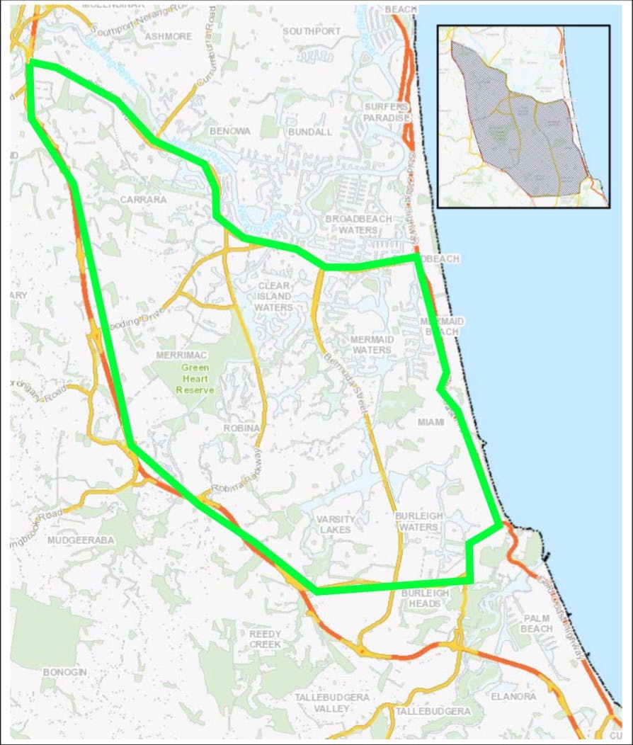
The study area is in Carrara, Clear Island Waters, Merrimac, Robina, Mermaid Waters, Miami, Varsity Lakes and Burleigh Waters. Click here to find out more about the study area.
Community engagement runs from 30 May to 26 June 2017.
-
About the study area
The Nerang River Catchment is the Gold Coast’s largest river system, with a total area of 49,329 ha.
The focus of this study is on the lakes and canals of the lower Nerang River Catchment. The Study area is bounded by Nerang-Broadbeach Road to the north, Gold Coast Highway to the east, Reedy Creek Road (i.e. Burleigh Connection Road) to the south and the Motorway (M1) to the west.
The Nerang River catchment can be divided into three sub-catchments: the upper, middle and lower reaches. Its upper reaches within the McPherson Range and the Springbrook Plateau deliver water from rainfall through rural areas and into the Hinze Dam and Little Nerang Dam which provides the majority of the Gold Coast’s drinking water supply.
The Nerang River continues its course from the Hinze Dam wall, flowing approximately 36km through rural residential and agricultural land use areas, reaching its tidal limit just upstream of Weedons Crossing, Nerang.
The tidal or estuarine region of the system traverses much of its length through urban residential areas and receives runoff from the Carrara/Merrimac floodplain before joining the Broadwater and flowing into the Pacific Ocean via the Gold Coast Seaway.
The map below shows the study area hightlighted in green.

-
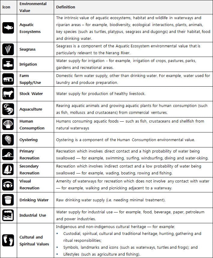
Environmental values information
Environmental values are particular values or uses of the environment that are important for a healthy ecosystem or for public benefit, welfare, safety or health and which require protection from the effects of pollution, waste discharges and deposits. The values used in this survey reflect those outlined in Environment Protection (Water) Policy 2009.

Signup Banner