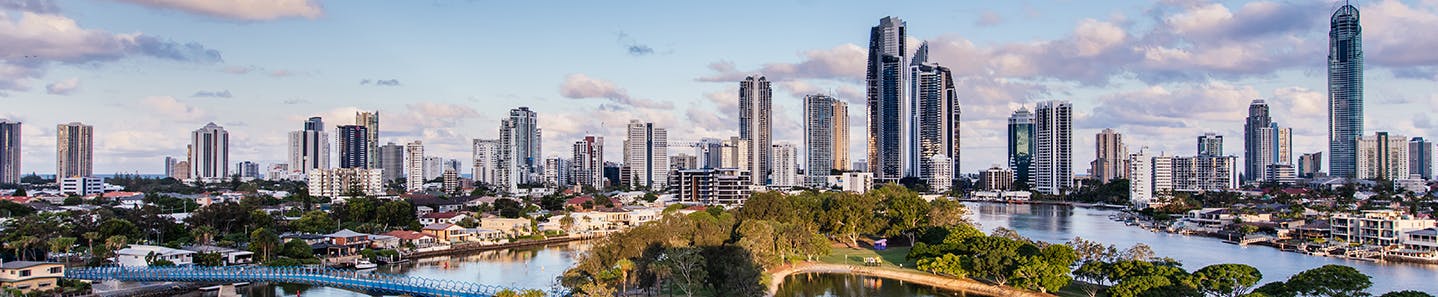
Our coastal city is dynamic and always changing. To protect and safeguard our city for the future, we’re developing the Coastal Adaptation Plan.
The plan builds on our existing coastal management strategies and best available science and economic studies, together with feedback received from the community during the first round of public consultation, to recommend cost-effective adaption options, now and into the future.
The first round of public consultation took place from 2 to 23 September 2020.
Have your say to go in the draw to win a GoPro Hero8 Black 4K HyperSmooth 2.0 Action Camera valued at approx. $499 (terms and conditions apply).
Community engagement runs from 19 January to 19 February 2021.
Feedback received will inform the final plan and recommendation of adaptation options.
The development of Our Resilient City - our plan for coastal adaptation provides a platform for conversations about what we value and how we manage our coastline together. If you are interested in our city's future resilience, we want to hear from you.
Choose a pin, share your story, photos or videos to help our coastal adaptation plans.
Join in the discussion by asking a question below.
The City, together with 41 other Queensland Councils, was awarded funding under the State Government's $12 million Coastal Hazards Adaptation program (QCoast2100) to develop effective plans to minimise the impacts of coastal hazards.
According to the State Government, by 2100 sea level rise is projected to be 0.8 metres with a possibility of cyclone activity increasing and tracking south more often. This means changes to coastal areas with increased erosion, storm tides and flooding in low lying areas. Visit QCoast2100.com.au
The City invests in managing and caring for our coastline. Our ongoing projects include the maintenance and construction of seawalls, sand pumping and dredging, landscaping and coastline infrastructure works.
Provide your suggestion below for mitigating coastal hazards?
Alternatively, if you have a question or feedback relating to a different council matter, please visit the contact us page on the City of Gold Coast website.
Will Gold Coast Light Rail stage 3 be raised above PMF or the revised Q100 flood levels such that evacuation can be facilitated and has Council budgeted to lift all its major roads and sewerage infrastructure above the new flood levels ?
JasonME
asked
over 3 years ago
Thanks for your queries Jason.
With respect to your enquiry about the Gold Coast Light Rail Stage 3, the Queensland State Government Department of Transport and Main Roads (TMR) is the project lead for this, and the City of Gold Coast role is as a collaborative partner. For all enquiries relating to the Gold Coast Light Rail please contact:
Email: gclr3@tmr.qld.gov.au
Phone: 1800 312 600
Furthermore, I note the City's major roads are also owned by the state government. Notwithstanding these roads, the timeframes associated with this current initiative (i.e. 2100), which includes the planning for any adaptation measures required for the management of Council's roads and sewerage infrastructure into the future, inherently requires a consideration of the necessary budgeting also. The development of the Coastal Hazard Adaptation Strategy is a great opportunity for the City to undertake this consideration.
Thank you again for your contribution.
Replant the shrubs and trees denuded from the Burleigh Heads areas due to the continuing illegal campers ruining the protection That has been there for years. I can’t manage to place a pin. I am a pensioner. Very interested in protection our incredible environment for future generations.
MAWard
asked
over 3 years ago
Thank you for your valuable feedback. You have raised a very important issue and the 'Our Resilient City' team will endeavour to ensure your feedback is captured in the development of the Gold Coast Coastal Hazard Adaptation Strategy. Additionally, we will provide your feedback to Council's Coastal Beaches Parks and Maintenance team for their review and for their maintenance planning (https://www.goldcoast.qld.gov.au/our-ocean-beaches-15174.html). For more information or to provide further feedback on planning for our City’s resilience to coastal hazards, feel free to visit or contact us again here https://gchaveyoursay.com.au/ourresilientcity.
We need an esplanade with shade through palm beach. Currently the entire esplanade from 23rd Avenue to Tallebudgera is devoid of shade. Given Queensland has the highest rates of skin cancer in the world- this is unacceptable. There is no where to rest or sit in the shade, and view the ocean at the same time. Tree planting along the esplanade for shade respite is essential to force the heat stroke in summer in the elderly and young, and to have sun safe options for walkers.
LRUhlmann
asked
over 3 years ago
Thank you for your valuable feedback. You have raised some very important points and the 'Our Resilient City' team will endeavour to ensure your feedback is captured in the development of the Gold Coast Coastal Hazard Adaptation Strategy. Additionally, we will provide your feedback to Council's Parks and Maintenance team for their review and for their parks maintenance planning. For more information or to provide further feedback on planning for our City’s resilience to coastal hazards, feel free to use the ‘Pin the map’ tool to tell us what else you value about our coastal environment here https://gchaveyoursay.com.au/ourresilientcity.
No question, is just like to see more trash bins and removal near waterways especially. They’re a lot of parks that are beside canal and river beaches and the rubbish is sitting waiting to be blown or picked up by the tide. These parks need special attention. I’d like to see rubbish pick up rallies organized as a fun community thing. Make a dint on the waste going out to see. Also cleaning what rubbish is already in the water. Canal by canal!
Marissa
asked
over 3 years ago
Hi Marissa, Thank you for your comments. You have provided valuable feedback and Council officers will endeavour to ensure these comments are conveyed to Councils Parks and Maintenance team. We will also ensure your feedback is reflected in the development of the Gold Coast Coastal Hazard Adaptation Strategy. Thanks again for taking the time to provide feedback.
If the Gold Coadt City Council is aware of rising sea levels and erosion of beaches why do they allow developments that go right to the edge of the beach?
WendyG
asked
over 3 years ago
Dear Wendy, thank you for your question.
While there is great demand for beachfront development on the Gold Coast, the City Plan regulates development that is identified within the Coastal erosion hazard overlay map. (You can view this overlay map by triggering the applicable checkbox on the left hand side of the City Plan mapping tool here: http://cityplanmaps.goldcoast.qld.gov.au/CityPlan/). Specifically, coastal development is regulated by the application of the Coastal erosion hazard overlay code, viewable at part 8.2.4 of the City Plan here: https://cityplan.goldcoast.qld.gov.au/ePlan/#Rules/0/51/1/0
This overlay code regulates requirements, such as the setback of new developments from the open coast (i.e. setback from the A-line) to allow construction of an in-ground sea wall; and the replanting of the sand dune tops to further mitigate erosion, among other provisions. Such measures have been long standing policies of Council since the 1980s to ensure that beachfront development is appropriately established.
In light of anticipated changes in coastal conditions, the current development of the Gold Coast Coastal Hazard Adaptation Strategy provides us, as a community, an opportunity to consider adaptation and management options for mitigating future coastal hazards. Accordingly, thank you for your question, as feedback allows consideration of a variety of ideas in the development of this strategy.
I am curious about the proposed development on the already flood-prone area on the waterway side of the Nerang - Broadbeach Rd Robina Parkway intersection when that land is lower than the adjacent roadways which still flood after heavy rain events. The signage at the site would suggest that approval has already been given, which appears to be ridiculous. Even if this is not the case, the proposal to build in this area is equally ridiculous and high-risk
Mary Toomey
asked
over 3 years ago
Hi Mary Toomey,
Thank you for providing your concerns and feedback in relation to development and the potential inundation in the Nerang - Broadbeach Rd / Robina Parkway area.
We are currently in the process of developing our plan for coastal adaptation, which factors in the sea level rise projections provided by the State Government. These projections include an increase of 0.8 metres by 2100.
This plan scopes the various adaptation options to respond to current and future coastal hazards. We are currently seeking input from our stakeholders and the community about what we value and how we respond to coastal hazards with cost effective adaptation options.
Your feedback and/or suggestions on planning for our City’s resilience to coastal hazards are encouraged via our ‘Pin the map’ tool on the ‘Our Resilient City’ webpage: https://gchaveyoursay.com.au/ourresilientcity. This will assist us to prioritise areas for future coastal adaptation based on what the community tells us they value the most.
Many of the Gold Coast's parks and open spaces are along creeks and beaches or on flood plains. Sea level rise will mean that many of these public open spaces will no longer be accessible to our growing population because they will be flooded. What steps are being taken as part of this current planning to ensure that there will be adequate public open space for residents and visitors?
LoisLe
asked
over 3 years ago
Hi LoisLe,
Thank you for your correspondence in relation to potential inundation of our valued parks and open spaces along creeks and beaches.
This plan scopes the various adaptation options to respond to current and future coastal hazards. We are currently seeking input from our stakeholders and the community about what we value and how we respond to coastal hazards with cost effective adaptation options.
Your feedback and/or suggestions on planning for our City’s resilience to coastal hazards are encouraged via our ‘Pin the map’ tool on the ‘Our Resilient City’ webpage: https://gchaveyoursay.com.au/ourresilientcity. This will assist us to prioritise areas for future coastal adaptation based on what the community tells us they value the most.
Is it possible this plan will result in changes to the mapped/adopted flood levels around Lake Orr in Varisty Lakes?
Harley Day
asked
over 3 years ago
Hi Harley Day,
Thank you for your correspondence in relation to potential inundation around Lake Orr in Varsity Lakes.
This plan scopes the various adaptation options to respond to current and future coastal hazards based on the State’s projected 0.8 metre sea level rise by 2100.
We are currently seeking input from our stakeholders and the community about what we value and how we respond to coastal hazards with cost effective adaptation options.
Any future changes to natural hazards overlay maps will be made in accordance with the Planning Act and Ministers Guidelines and Rules.
Your feedback and/or suggestions on planning for our City’s resilience to coastal hazards are encouraged via our ‘Pin the map’ tool on the ‘Our Resilient City’ webpage: https://gchaveyoursay.com.au/ourresilientcity.
With light rail, all of northern Palm Beach from Tallebudgera creek to 19th Avenue needs to become an esplanade. This will ensure the whole of palm beach can be one consistent esplanade. If this is not done, there will be traffic backing up from 19th Avenue back over Tallebudgera creek. As this is where children and young families swim it will be a huge hazard. Equally, ensure adequate crossing points across the GC highway from the west to the east. Trying to cross heavy traffic to get to the beach across rail tracks will be very hazardous.
LRUhlmann
asked
over 3 years ago
Thank you so much for providing feedback through our Coastal Hazard Adaptation Strategy engagement process. The important matters you have raised are relevant to several areas of authority, including the Queensland Department of Transport and Main Roads, so in the first instance you may wish to contact the Department.
With respect to Council, our Traffic and Transport division can be contacted via 5582 8211 or mail@goldcoast.qld.gov.au. More specifically however, the Department of Transport and Infrastructure are seeking feedback on the Light Rail here: https://gclr3.com.au/
For more information on planning for our City’s resilience to coastal hazards, or to provide feedback regarding the development of our Coastal Hazard Adaptation Strategy, please feel free to navigate through the ‘Our Resilient City’ webpage https://gchaveyoursay.com.au/ourresilientcity and tell us what you value about our coastal environment using the ‘Pin the map’ tool.
What is the GCCC plan to minimise the effects of rising sea water due to global warming in Jacobs Well and Cabbage Tree Point? As it is some of the lower lying areas are already affected by even moderate rainfall. Some houses regularly flood a d those of us with septic tanks have problems with that as well.
madtam
asked
over 3 years ago
Hi madtam,
Thank you for your feedback. Your interest in minimising the effects of sea level rise and climate change in Jacobs Well and Cabbage Tree Point has been captured and will assist us to understand what the Gold Coast community values and how we need to plan to minimise the risk of these hazards in the future.
We are currently in the process of developing our plan for coastal adaptation, which factors in the sea level rise projections provided by the State Government. These projections include an increase of 0.8 metres by 2100.
For more information or to provide further feedback on planning for our City’s resilience to coastal hazards, feel free to navigate through the ‘Our Resilient City’ webpage https://gchaveyoursay.com.au/ourresilientcity and tell us what you value about our coastal environment using the ‘Pin the map’ tool.
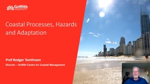
Click here to play video
Coastal processes, hazards and adaptation
A presentation on Coastal processes, hazards and adaptation by Professor Rodger Tomlinson.
Project timeline
Phase 1 - Completed
Our plan for coastal adaptation has finished this stage
Planning for life of project stakeholder communication and engagement
Phase 2 - Completed
Our plan for coastal adaptation has finished this stage
Scope coastal hazard issues for the area of interest
Phase 3 - Completed
Our plan for coastal adaptation has finished this stage
Identify areas exposed to current and future coastal hazards
Phase 4 - Completed
Our plan for coastal adaptation has finished this stage
Identify key assets potentially impacted
Phase 5 - Completed
Our plan for coastal adaptation has finished this stage
Risk assessment of key assets in coastal hazard areas
Phase 6 - Completed
Our plan for coastal adaptation has finished this stage
Identify potential adaptation actions, including feedback from community
Phase 7 - Completed
Our plan for coastal adaptation has finished this stage
Socio-economic appraisal of adaptation options
Phase 8 - Finalising
Our plan for coastal adaptation is currently at this stage
Strategy development, implementation and review, including community feedback on the draft strategy